|
|
|
|
|
The Caney
Fork of the Cumberland |
|
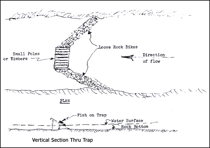
There are a number of references to Fish Traps, sometimes called Fish Dams, in the early deeds. They were located on the shoals where the river was relatively shallow. Loose rock dams were built out from each bank of the river to a wood structure supporting poles or slats at an angle of about 30 degrees, spaced about 2" apart. Even though the rock dams were not water tight, the level of the river was raised so that the velocity of the water through the slats was quite rapid. Small fish passed through but the large ones were caught on the slats and due to the water pressure could not get away. As Jim Baker of Campaign used to say, "It was just a matter of walking out to the trap and picking up a mess of fish for supper."
The group of explorers who traveled down the Cumberland
in 1769-70 and then cut across Roaring River to the Caney Fork referred
to a very ingenious "fish trap on the upper Cumberland built of limbs
and brush." It must have been built by the Indians.
There were probably many others located on the upper Caney Fork and its tributaries. They were fragile and easily washed out. The lower Caney Fork was considered navigable up to Frank's Ferry and such structures would not have been permitted in the main channel although they might have been built in narrow channels on one side of an island. |
|
|
|
 |
|